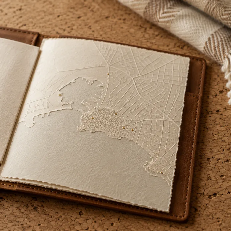
Reading the montevideo uruguay map as a luxury city blueprint
Montevideo rewards travelers who read its urban fabric like a refined montevideo uruguay map rather than a simple list of tourist stops. The city stretches along the Río de la Plata in the south of Uruguay, and its waterfront avenues, historic plazas, and residential areas shape where premium hotels quietly frame the skyline. When you plan a trip with detailed city Uruguay cartography in hand, you immediately see how distance, traffic, and shoreline views will define your time in each neighborhood.
On any high quality map of Montevideo Uruguay, three axes matter for luxury guests: the coastal rambla, the historic Ciudad Vieja, and the residential east around Pocitos and Punta Carretas. The coastal strip runs for more than 20 km (the official municipal coastline is about 22 km, according to the Intendencia de Montevideo[1]), and choosing a hotel along this curve means you can walk between beaches, plazas, and parks while keeping the south facing river always in view. A precise destination guide that overlays five star properties on the city grid helps you compare areas by walking time to key landmarks such as Plaza Independencia, Palacio Salvo, and the Solís Theatre.
Historic city escapes work best when your Montevideo city map shows both heritage and lifestyle layers. One layer highlights Ciudad Vieja, the Metropolitan Cathedral, and the Montevideo Metropolitan Cabildo around the main square, while another layer marks gastronomic streets, wine bars, and design focused hotels in Pocitos and Punta Carretas. By reading how each area connects to the port, the airport, and the bus terminal Tres Cruces, you can align your trip logistics with the most atmospheric parts of the city rather than losing time in transit.
Historic Montevideo: mapping Ciudad Vieja, plazas, and palacios
The historic heart of Montevideo is compact, and a good montevideo uruguay map shows that most major monuments sit within a few hundred meters of each other. Ciudad Vieja forms a peninsula at the west of the city, and its grid of streets leads naturally toward Plaza Independencia, the symbolic square where the old and new city meet. For travelers booking luxury hotels, this area offers quick access to museums, government palaces, and the port, while still allowing a quiet retreat once the day’s tourist crowds thin.
On the north side of Plaza Independencia stands Palacio Salvo, whose ornate tower remains one of the most recognizable silhouettes in South America. Many premium hotels use Palacio Salvo as a reference point on their city Uruguay directions, because from this square you can walk to the Solís Theatre, the Metropolitan Cathedral, and the Montevideo Metropolitan Cabildo in less than ten minutes. When you study a detailed map, you see how this square anchors the transition from the colonial Ciudad Vieja to the modern business district, which is useful if your trip mixes meetings and cultural evenings.
Several high end properties cluster within a short walk of the Solís Theatre and the Metropolitan Cathedral, and their concierges often provide printed destination guides that highlight both daytime and nighttime routes through the area. These guides usually mark safe walking streets, recommended cafés on each plaza, and the quickest way back to your hotel if you attend a late performance at the Solís Theatre. For a broader view of where to stay across Uruguay beyond Montevideo, many travelers consult a region by region sleep map for first time visitors, which helps compare Montevideo’s historic core with coastal resorts and inland estancias.
From Pocitos to Punta Carretas: coastal neighborhoods on the map
East of the center, the montevideo uruguay map reveals a graceful curve of coastline where Pocitos and Punta Carretas host many of the city’s most sought after premium hotels. Pocitos beach forms a long urban bay, and its promenade attracts joggers, families, and business travelers unwinding after meetings in the city. When you choose a hotel here, you trade immediate access to Ciudad Vieja for a more relaxed waterfront atmosphere, yet a taxi ride back to the main square usually takes less than twenty minutes depending on time of day.
Punta Carretas lies just south of Pocitos, and on the map you can see how its peninsula pushes into the Río de la Plata toward Punta Brava and the historic lighthouse. The Punta Carretas area combines upscale residential streets, a major shopping center, and a string of refined restaurants that make it ideal for travelers who want both quiet nights and easy access to the city’s dining scene. Many luxury hotels in Punta Carretas highlight their proximity to the lighthouse at Punta Brava, because the walk to this point offers wide views of Montevideo Uruguay and the river horizon.
Food focused travelers often use a montevideo uruguay map not only for streets but also for planning where to eat when a business trip turns into a long weekend. In Pocitos and Punta Carretas, you will find a dense cluster of Uruguayan parrillas, seafood restaurants, and contemporary bistros that pair well with the coastal setting. A curated guide to the Montevideo table helps you match each neighborhood on the map with its signature dishes, from grilled corvina near the lighthouse to slow lunches in shaded squares back toward the city center.
Parque Rodó and cultural escapes between parque and plaza
Between the historic center and the eastern beaches, the montevideo uruguay map shows a green hinge called Parque Rodó, which blends lakes, lawns, and cultural institutions. Parque Rodó sits south of the main city avenues and close to the coastline, making it a strategic area for travelers who want both park views and quick access to Pocitos or Ciudad Vieja. Several premium hotels around this parque offer rooms overlooking tree lined streets, giving a softer urban experience than staying directly on a busy square.
On many tourist maps, Parque Rodó appears as a single green block, but in reality the parque and its surrounding streets form a layered cultural district. The National Museum of Visual Arts stands on the park’s edge, and from there you can walk toward the rambla or back into residential streets that host cafés and small galleries. When planning your trip, it helps to note walking times from your hotel to Parque Rodó, Pocitos beach, and Plaza Independencia, because this triangle defines how you will move through Montevideo during a short stay.
Families and couples often appreciate how the parque area softens the city’s rhythm, especially on weekends when locals gather around the lake and the fair. A detailed Montevideo map lets you trace safe walking routes from hotels near Parque Rodó to the coastline at Punta Carretas or to the cultural venues closer to the Solís Theatre. If you are exploring Uruguay beyond the capital, you can also use specialized guides to plan weekends that combine Montevideo’s parks with rural escapes, such as golf among the capybaras at Garzón Tajamares, which lies several hours away but complements an urban stay.
From Montevideo to Punta del Este: mapping coastal extensions of your trip
Many luxury travelers use Montevideo as a starting point before continuing along the coast of Uruguay toward Punta del Este and other resorts. On a broader south America map, you can see how Montevideo, Punta del Este, and the smaller point of Punta Brava align along the Río de la Plata and the Atlantic, forming a natural route for a multi stop trip. Planning with this regional view helps you decide how many nights to allocate in the city versus the beach, especially if you are flying in from Buenos Aires or another Latin America hub.
From Montevideo, the road to Punta del Este runs roughly east along the coast, and many travelers choose to spend one or two nights in the capital before heading to the resort area. A detailed destination guide often suggests starting with historic walks around Ciudad Vieja and Plaza Independencia, then moving to a hotel in Pocitos or Punta Carretas for a final night before driving to Punta del Este. This sequence allows you to experience both the city’s plazas and the more relaxed waterfront neighborhoods without rushing, while still reaching the beaches in good time.
On a combined Montevideo Uruguay and Punta del Este map, you will also notice secondary points such as the Brava Lighthouse near Punta del Este and the lighthouse at Punta Brava in Montevideo. These lighthouses mark the transition between river and ocean, and they often appear in destination photography that promotes Uruguay as a south America coastal escape. When comparing hotels, look at how each property positions itself relative to these landmarks, because a room facing the water or within walking distance of a lighthouse can significantly elevate the feel of your trip.
Practical map reading tips for premium hotel bookings
Using a montevideo uruguay map effectively means going beyond pins and ratings to understand how the city’s structure affects your stay. Start by marking your non negotiable points of interest, such as the Metropolitan Cathedral, the Solís Theatre, or a specific plaza where you have meetings. Then measure walking times from candidate hotels to these locations, remembering that a ten minute walk across a flat square feels very different from a similar distance along a busy avenue.
For coastal neighborhoods like Pocitos and Punta Carretas, check how far your hotel sits from the rambla and from the nearest beach access on the map. Some properties advertise sea views, but a close reading of the city Uruguay grid may reveal that they are set several blocks inland, which changes your daily experience. In the historic Ciudad Vieja, verify how your hotel relates to Plaza Independencia, Palacio Salvo, and the Montevideo Metropolitan Cabildo, because being one block closer to the main square can save significant time over several days.
Luxury travelers should also pay attention to how the map shows elevation, park boundaries, and one way streets, especially if they plan to use private drivers. In areas around Parque Rodó and the parque facing coastline, certain streets can become congested at specific times, which affects transfers to and from the airport. By combining a detailed destination guide with your own annotated map, you can align your hotel choice with your preferred rhythm, whether that means quiet evenings near a parque or late nights near the Solís Theatre and the main plazas.
Contextualizing Montevideo within south America and Latin America travel
On a continental scale, Montevideo appears on the south America map as a compact capital facing Buenos Aires across the Río de la Plata. This position makes Montevideo Uruguay an attractive stop on multi city itineraries that link Buenos Aires, Santiago, and other Latin America hubs. For travelers focused on historic city escapes, the combination of Montevideo’s Ciudad Vieja, its plazas, and its coastal neighborhoods offers a softer, more walkable alternative to some larger regional capitals.
When you zoom in from a regional map to the city level, you see how Montevideo’s layout reflects Uruguayan history and urban planning choices. The alignment of Plaza Independencia, Palacio Salvo, the Metropolitan Cathedral, and the Montevideo Metropolitan Cabildo along a central axis tells the story of political and religious power in the city. Meanwhile, the spread of residential areas like Pocitos and Punta Carretas toward the south facing coastline shows how Montevideo has grown toward the water over time.
For premium hotel booking platforms, presenting Montevideo within a broader Latin America destination guide helps travelers compare it with other coastal capitals. Clear maps that show flight times from Buenos Aires, road distances to Punta del Este, and walking times between key plazas in the city give users confidence when choosing where to stay. By integrating these cartographic details into the booking experience, platforms can turn a simple montevideo uruguay map into a strategic tool that shapes more satisfying, better balanced trips.
Key figures for mapping Montevideo and planning stays
- Montevideo’s urban coastline extends for roughly 22 km along the Río de la Plata, which means many premium hotels can offer water views within a short walk of the rambla (figure based on municipal planning data from the Intendencia de Montevideo[1]).
- The distance between Plaza Independencia in Ciudad Vieja and the center of Pocitos is about 5 km, translating into a 15 to 20 minute drive depending on traffic (distance verified using standard online mapping tools such as Google Maps and OpenStreetMap[2]).
- Driving from Montevideo to Punta del Este covers approximately 130 km, and most travelers complete the trip in about two hours by car or private transfer (as indicated by Uruguay’s national road network information and common routing on digital maps[2]).
- Montevideo’s metropolitan area concentrates close to half of Uruguay’s population, which explains the density of cultural venues and high end hotels around the historic center and coastal neighborhoods (based on census data from Uruguay’s Instituto Nacional de Estadística, INE[3]).
- The walk from Plaza Independencia to the Solís Theatre and the Metropolitan Cathedral typically takes less than 10 minutes, making this area particularly convenient for travelers who value compact historic districts (timing confirmed on foot and via digital city maps[2]).
FAQ about using a montevideo uruguay map for luxury hotel stays
Which Montevideo neighborhood is best for a first luxury stay ?
For a first visit, many luxury travelers choose between Ciudad Vieja near Plaza Independencia and the coastal areas of Pocitos or Punta Carretas. Ciudad Vieja offers immediate access to historic sites like Palacio Salvo, the Solís Theatre, and the Metropolitan Cathedral. Pocitos and Punta Carretas provide a calmer waterfront setting while remaining a short drive from the main square.
How long should I stay in Montevideo before going to Punta del Este ?
Most travelers planning a combined city and beach trip allocate two or three nights in Montevideo before continuing to Punta del Este. This duration allows time to explore Ciudad Vieja, Parque Rodó, and the coastal rambla without rushing. It also gives flexibility for a business meeting or a performance at the Solís Theatre.
Is Montevideo walkable for visitors staying in premium hotels ?
Central Montevideo is highly walkable, especially around Ciudad Vieja, Plaza Independencia, and the nearby business district. Many premium hotels in these areas sit within a short walk of major plazas, museums, and theatres. Coastal neighborhoods like Pocitos and Punta Carretas are also pedestrian friendly along the rambla and main avenues.
How should I use a map when choosing a Montevideo hotel ?
Start by marking key places you plan to visit, such as the Metropolitan Cathedral, the Solís Theatre, and your meeting addresses. Then compare hotels by walking time to these points and by proximity to the rambla or main plazas. Finally, check transport routes to the airport and bus terminal to avoid long transfers at peak times.
Is Montevideo a good base for exploring other parts of Uruguay ?
Montevideo works well as a base because it connects efficiently to Punta del Este, Colonia del Sacramento, and inland wine or estancia regions. Many travelers spend several nights in the city, then add side trips by car or bus. A regional map helps you visualize these routes and decide how to divide your time between the capital and the countryside.
Sources: [1] Intendencia de Montevideo, municipal coastline and planning data; [2] Standard online mapping tools such as Google Maps and OpenStreetMap for distances and driving times; [3] Instituto Nacional de Estadística (INE), population and metropolitan area statistics.